I have a professional background in journalism (MA from UNC-CH), public affairs, and more recently public health (MPH, University of Washington). I publish several online properties, including my web site www.rudyowens.com. I also am an author of the first-ever memoir and public health examination of the U.S. adoption system ("You Don't Know How Lucky You Are," BFD Press, 2018).
This is my friend, Lars, who I had the great pleasure of meeting in 1998 in Sisimiut, Greenland. He took me seal hunting with his family, at a fjord just north of the coastal city. I did this trip with his brother and father.
This past week, from March 23 to 28, 2025, the world again saw Greenland and Greenlanders at the center of a global security debate if the United States could assert control of Greenland, beyond longstanding and existing security arrangements that have seen U.S. military on the island continuously since World War II.
After the snow settled, one outcome was clear: Greenlanders are nobody’s fools.
The mostly ethnical Inuit population have called the more than 830,000-square-mile arctic island, the world’s largest, their home for nearly 5,000 years. Today, Greenlanders number about 57,000 residents, of which nearly 90 percent claim ethnic Inuit identity.
They are smart, resilient, and fiercely grounded in their identity as descendants for nearly five millennia of their homeland, what they call Kalaallit Nunaat in their Greenlandic language.
They are not pawns, patsies, or stupid.
I can say this based on my own experience, having befriended many residents there during my visits in 1998, 1999, and 2000. During my trips now more than a quarter century ago, I had lively discussions with Greenlanders who shared divergent views of becoming independent or staying aligned under semiautonomous status with Denmark.
What is clear is that Greenlanders made abundantly clear to the world they are opposed to coming under greater military and political control of the United States, as announced by the Trump administration.
(See my full story on the significance of Trump administration’s plan to take full control of Greenland on my website.)
Finland’s Independence Day, itsenäisyyspäivä, is celebrated each year on December 6. It commemorates the day the Finnish Parliament declared independence from Russia in 1917, as Europe was being torn apart by World War I and as Russia was convulsing in its own violent revolution. Finland would soon have its own bloody civil war soon after, in 1918, with the German-backed “whites” defeating the USSR-supported Finnish communist forces, the “reds,” with a decisive and destructive battle in Tampere led by Finnish war hero Carl Gustaf Emil Mannerheim.
For the Finnish people, it marked the first time ever that the country was finally free of foreign domination after more than 700 years of colonization, Christianization, and conquest and rule by Sweden, from the mid-12th century to 1809. It then endured 108 years of Russian domination and rule. It finally became a nation amid the chaos of World War I.
After the Tsar’s rule was toppled, the Parliament of Finland made its Declaration of Finnish Independence on December 6, 1917. The new Nordic nation sent requests to be recognized as a sovereign country to Sweden, Norway, Denmark, Germany, France, and the United Kingdom. The Bosheviks in what became the USSR formally acknowledged Finnish independence on December 31, 1917.
Many Finnish citizens in most communities commemorate their independence with formal and solemn events, often involving war memorials than can be found in every city and every community, no matter how small, throughout the Nordic country, like this event planned for December 6, 2024 in Kuopio, at a memorial, or at churches, like this event the same day in Helsinki.
My Finnish relatives, who I only met for the first time in September 2023, told me the day for most Finns has special significance as a remembrance of the war dead, who died in Finland’s three conflicts during World War II: The Winter War, against the USSR (1939-40); the Continuation War (1941-44), against the USSR; the Lapland War against Nazi Germany (former ally, 1944-45). Some of the pictures I’m seeing posted as day awakens in Finland on December 6, 2024, are of people reading the great Finnish war novel, Väinö Linna’s The Unknown Soldier/Tuntematon Sotilas.
It was a brutal time, when Finland, a much smaller nation, faced an adversary with vastly superior resources and weaponry and withstood an unprovoked attack at great cost. Finland ultimately lost more than 10 percent of its land, but was never brutally occupied by the USSR like Estonia, Lithuania, and Latvia, or like other Nordic countries, Denmark and Norway, by Nazi Germany. However, the Nazis fought a scorched earth campaign in late 1944 and early 1945 against Finland when Finland turned on them to reclaim their nation and make peace with the USSR. The Germans left a trail of ruin as they were driven from Lapland, where they once were stationed as allies. The harsh peace signed with the USSR ultimately saw Finland retain its territorial integrity and maintain its independence against heavy odds.
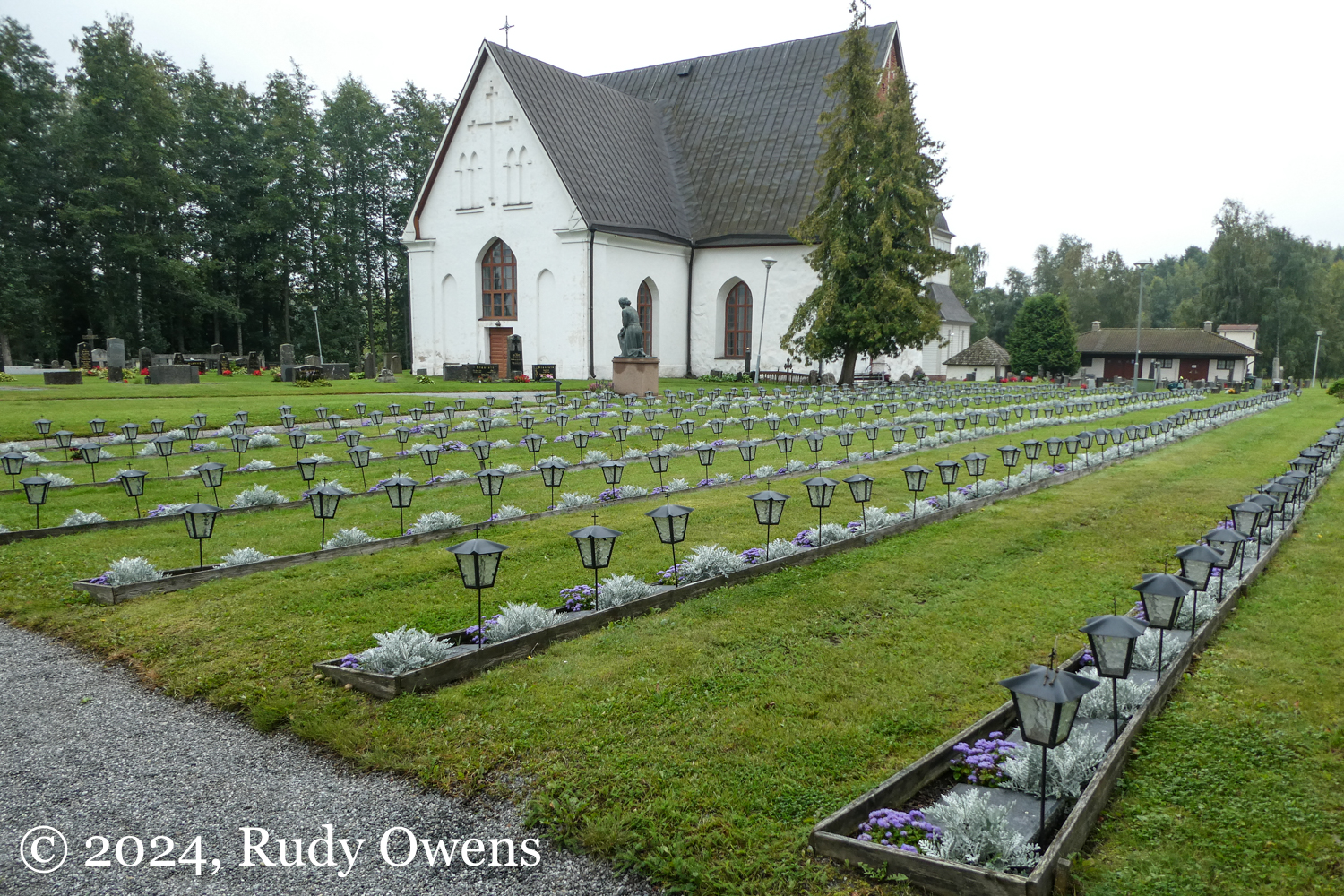
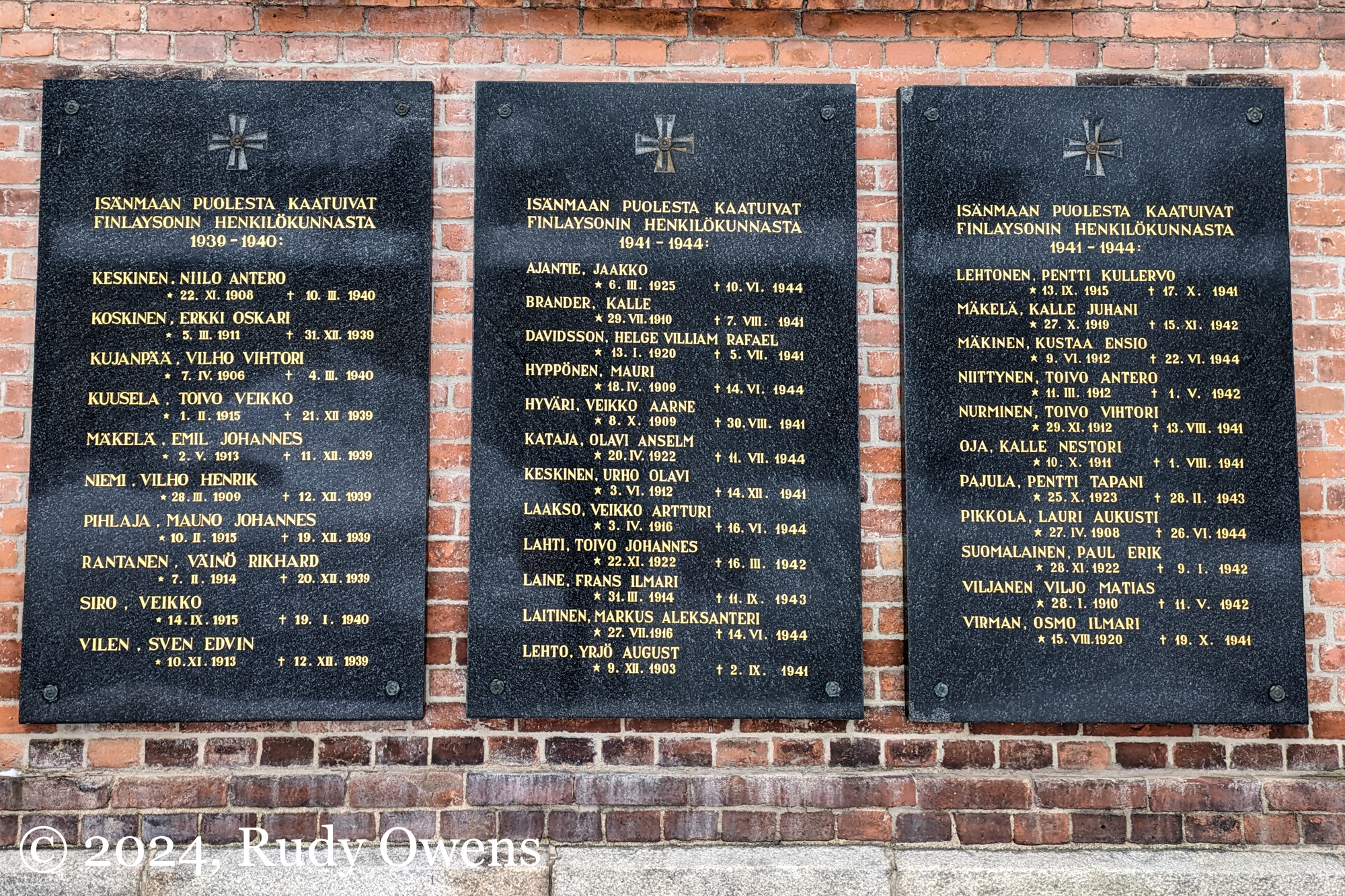
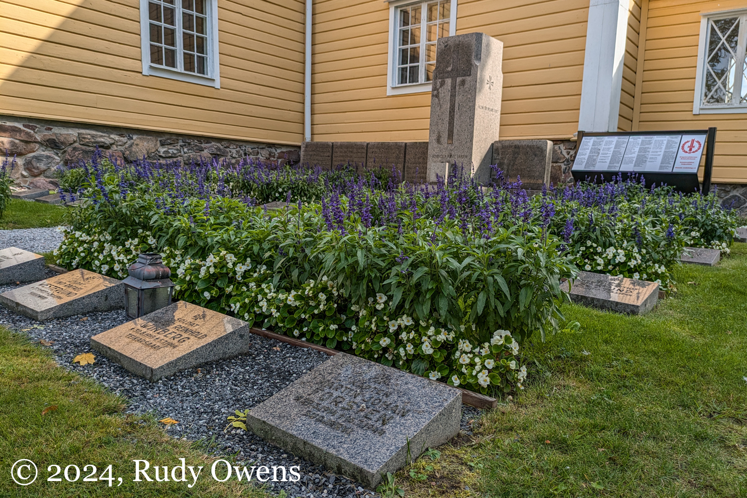
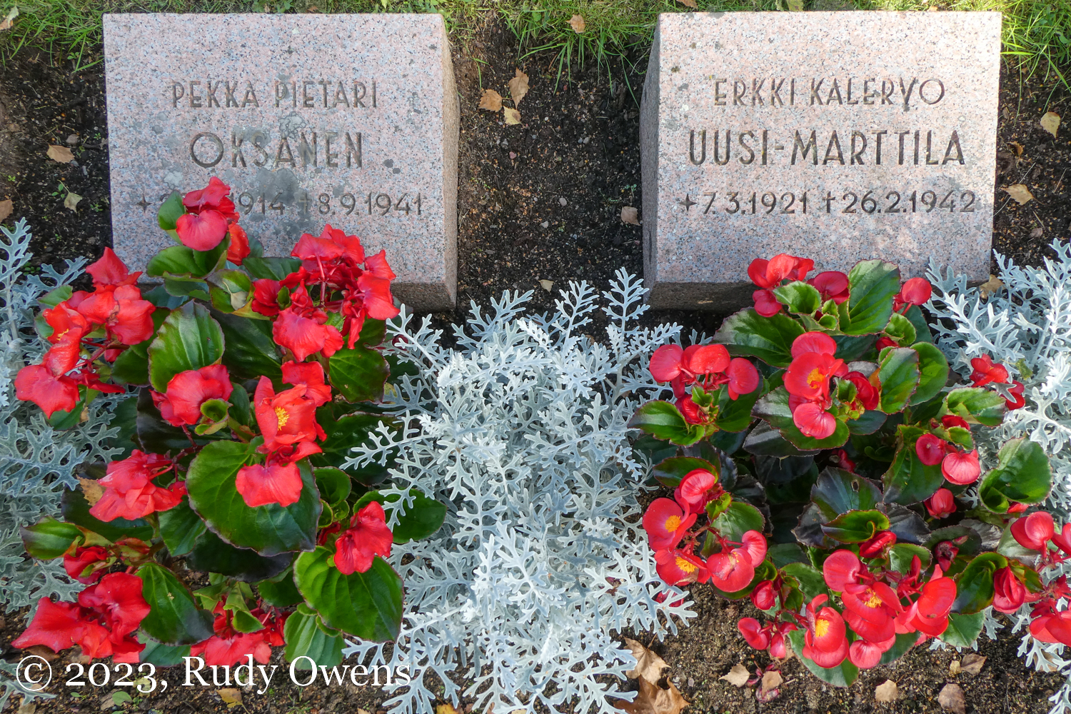
During my three trips to Finland since August 2023, I have been documenting the way the country and its people remember the trauma of these wars, taking photographs of its war memorials and markers for the dead. Nothing has shaped modern Finnish identity more than these conflicts that took 95,000 lives of its soldiers between 1939 and 1945. Finland’s remembrance of these traumatic experiences are found in nearly every Finnish community, no matter the size or location.
Every city and village I visited had memorials. All of them. So I would stop my rental car, get out, and document what I found. Flowers were always fresh. Always. Every memorial I saw everywhere had fresh flowers. Everyone I went to had visitors. The past was always remembered. If you look for Finnish news of itsenäisyyspäivä, inevitably there will a photo at a memorial.
I’m getting to be an old fart. As such, I actually want to do another Baltic Sea crossing between Sweden and Finland on these cruise ships. They are fun. On my trip from Turku to Stockholm on the Viking line, I met a fabulous German couple who even guided me nicely to downloading the right local transport app and picking the right bus and subways to the central station from the ferry terminal in beautiful Stockholm. How about that! Also, you get to behold old farts like me disco dancing in the discos, the mad rush to buy duty-free booze by huge crowds of Nordic travelers stocking up for months, and the wonderful upper deck views of this lovely part of the world.
(Click on each photograph to see a larger picture on a separate gallery picture page)
Freshly back from my glorious 11-day trip in Finland in September 2023, I have begun seeing a surprising number of articles on Finnish saunas.
On November 24, 2023, the BBC ran a multimedia spread under the banner “Saunas: The essence of Finland’s heartbeat,” featuring a refreshingly accurate video by Maria Teresa Alvarado, aided by producer by Natalia Guerrero. The video began showing a scene of a typical Finnish sauna, with a Finnish voice saying, “A Finn without a sauna is like a polar bear without ice and snow.”
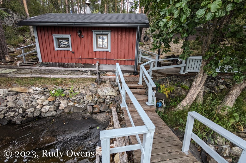
A traditional outdoor sauna, located next to Lake Saimaa, north of Savonlinna
A month earlier, on October 24, 2023, the famed British news service ran another glowing piece called “The 10,000-year-old origins of the sauna – and why it’s still going strong,” on this ancient Finnish tradition of taking hot air baths in wooden sheds that stimulate excessive sweating, often followed by immersion in cold water, snow, or cold weather.
Finland’s Baltic neighbor Estonia shares an equally old sauna tradition, and its sauna traditions this year are getting buzz thanks to the film “Smoked Sauna Sisterhood” (“Savusanna Sõsarad” in Estonian), a 2023 documentary on that country’s ancient sauna tradition and the women who partake in it. It just won the best documentary film award on December 9, 2023 at the European Film Awards.
Saunas: hot, hot, hot everywhere!
Yes, saunas are clearly the sweaty, hot ticket in many spaces.
Even in the U.S. medical establishment, which has never embraced practices that can’t be tied to for-profit enterprises that prioritize profit over health, some medical researchers are suddenly acknowledging the extensive and documented health benefits of saunas.
The modern Finnish sauna is but one of many “sweat lodges” and saunas that emerged globally, but none more famously than the Finnish sauna.
The BBC’s October 24, 2023 story by Clare Dowdy explored the history of the sauna in Finland and the Baltic region and its cultural significance to Finland, from the past to present: “In Finland, the sauna is ‘one of the key national symbols’, says [Dalva] Lamminmäki, precisely because it’s very much an everyday ritual for Finns, with 3.3 million saunas in a country of 5.5 million inhabitants. ‘Everyday practices are relevant to national identity also because over time they form a widely shared understanding of the culture and what it is like to be a citizen of a country,’ she adds, ‘It’s said that sauna creates a basis for understanding what Finnishness is.’”
This week, I stumbled on still another glowing article, published in The Guardian on December 6, 2023 , on the foundational importance of sauna’s to Finland’s enviable status as the “happiest country in the world” six years in a row.
Writer Miranda Bryant visited Tampere, “sauna capital of Finland,” and explored its well-known public saunas—the city boast almost five dozen of them. Bryant praised the tradition and suggested they are a foundation to Finland’s success creating national wellbeing.
“Unlike in other countries, where saunas are usually marketed as an expensive activity for the few, in Finland they have a far more everyday role,” writes Bryant. “Many people have saunas in their homes; lots of older Finnish people were even born in saunas. But they are also considered a sacred space and a place to find community as well as peace.”
The difference between real and fake sauna experiences
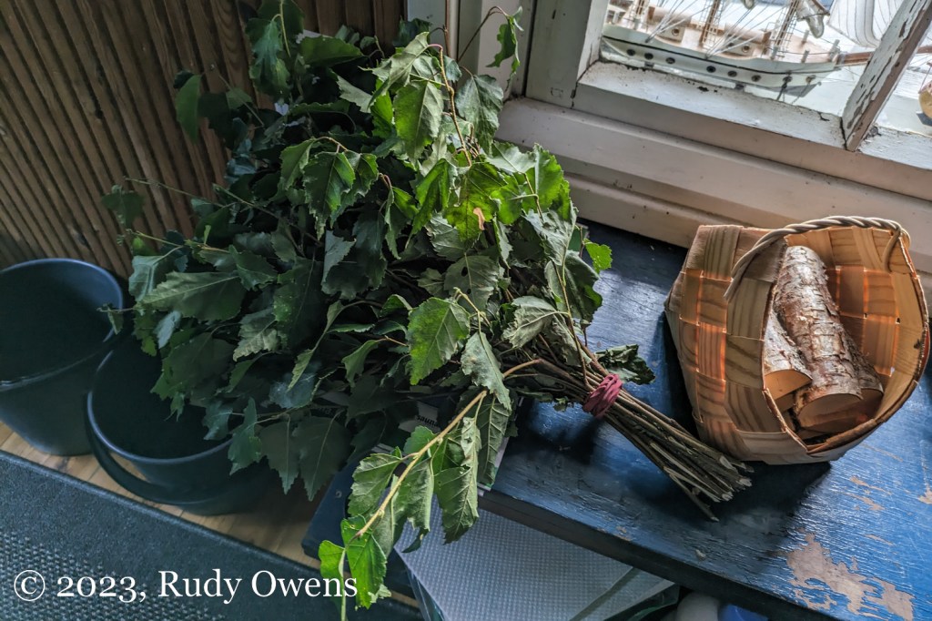
It could be that I’m more aware of saunas because I used them and sought out traditional and public sauna experiences during my trip in Finland.
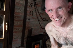
Rudy Owens experiencing the pleasure of a traditional wood-burning sauna next to Lake Saimaa.
I also think saunas are now trending as the latest “it” thing in wellness or boutique healthcare that really is a mask for old-fashioned narcissism.
This week, I saw a mobile sauna being advertised for a price of $45 for an hour at a Portland event. The branding of this new fad in “Instagram poseur” imagery typically leans heavily into maximum cleavage and/or a hot yoga bod, with the sumptuous sauna user looking sumptuously fulfilled.
From what I can tell, that is how many sauna services and products are marketed to U.S. consumers—something for “special” people, meaning those who are sexier, more charismatic, and definitely healthier than you. They definitely have a hotter bod than you too!
Public sauna, Helsinki, and not a hot body in sight
I eventually hit a breaking point on the corruption and meaning of saunas, to human health and to their egalitarian and cultural roots in Finland, but also Estonia, other Baltic countries, and also Russia through hot baths called banya.
I especially appreciated the photos of saunas that Bryant profiled in her Guardian feature story, and also on the City of Tampere’s tourism website promoting the city’s many facilities. That webpage, showing people of all different body types—not one a smoking beauty—notes: “Did you know there are over 55 public saunas in Tampere region for anyone to relax in, throughout the year? Finnish sauna culture is also a part of the UNESCO Intangible Cultural Heritage list.”
I decided to borrow some images I found on websites that showcase differences between U.S. and Finnish sauna imagery for editorial commentary.
These honest pictures matter, because they show a sauna is not the domain of Instagram narcissists. They show guys half naked drinking beer outside or people of all body types wandering outdoors in the cold after plunging into a frozen lake. That’s how they do it. And they are really wonderful.
After hitting my sauna boiling point, practically steaming, I kvetched to some of my Finnish relatives who live in Tampere (I know, isn’t that a cool coincidence!) on how American “entrepreneurs” are trying to turn saunas into snobby, high-end, upper middle-class, white, health salvation spas for the “right kind of people,” promoted by scantily clad sexpots showing beaucoup de cleavage and draped in towels. I shared it was driving me nuts. They all responded with funny emojis, and one of them suggested I needed to join them at Tampere’s Rauhaniemi folk spa, which has a nice, icy-lake, winter swimming option.
I’m glad we are seeing the far more realistic image of what saunas are like.
They are very democratic and plebeian, especially in countries like Estonia and Finland. Naked typical bodies are not oozing with steam like yoga skankiness. There, the sweaty bodies are rather normal looking. And in a sauna, you show the flesh in all its perfectly imperfect glory.
(Click on each photo to see a larger picture on a separate picture page.)
Consistent with my “all things that are cool are Finnish” approach to thinking now, I found wonderful nuggets of new insights from books I have been reading about one of my ancestral homelands, Finland.
For those who may never check out books from a library, this summary is for the lay person who doesn’t want to wade through data summaries on health, education, longevity, maternal care, and income inequality, which Finland continues to excel at relative to nearly every developed country.
One area where Finland shines is the country’s national character. That character is defined by an important concept and word called “sisu.” I connect deeply to this idea too, and I could see it during my trip there in September 2023.
This is what Danny Dorling and Annika Koljonen, authors of the wonderful book published in 2020 on Finland’s successes as a nation, called Finntopia, wrote in describing what sisu means. It is, my view, one reason why Finland to stands out among all developed nations. I see their national successes tied to their cultural identity.
According to Dorling and Koljonen: “The clue is the word, ‘sisus,’ which [in Finnish] is literally the interior, or inside of a thing or a being. Then it hit me that sisu is like the somatic embodiment of mental toughness. What we attribute to the mind–our strength and ability to keep going no matter what–is also reflected in our bodies, in our physical being.”
For me, the power of sisu is very personal. It resonates with everything I do in life and the things that have meant the most to me in helping me a better person.
As I’ve long said, I connected to this part of myself, the part I had to find through hard times, which in the end, led to things that I cherish now. Maybe there is something genetic that connects me to my Finnish ancestors in how I ended up.
Yes, I believe that to be true. Ask a Finnish person what makes them Finnish, and you may hear them explain sisu.
(Click on each photo to see a larger picture on a separate picture page.)
Portland does get its summer concerts in the parks right, even if so many other things are not going well.
We have a lot of issues now in our city, from a wave of gun violence to massive open air drug use of deadly fentanyl, and the failure of our community to meet these and other challenges. These problems have also led to an exodus of nearly 3 percent of Multnomah County’s population since 2020.
In fact, this week, the local weekly newspaper, Willamette Week, published a litany of woes that national and international journalists have shared about the falling star that Portland has become from its quirky, almost rock star status less than a decade ago.
“Portland is on a short list of destination cities for national media,” wrote the Willamette Week. “Rather than a model, however, we have become a cautionary tale. It wasn’t long ago that the nation’s leading newspapers and magazines regularly wrote the same glowing profile of the Rose City—a lovably weird outpost wedged between the Cascades and the Pacific where colorful (but mostly white) residents pedaled tall bikes while playing the bagpipes, eating Voodoo doughnuts, and slurping elderflower-flavored kombucha.”
The Voodoo doughnuts and bagpipes were always absurdities and click-bait style gimmicks disconnected from lived reality of nearly everyone who lives here, but that’s what feeds the media and social media appetites.
Portland, and its countless brand messengers, ran with it, until the city hit the brick wall of harsh reality. This collision of fantasy and reality has made us a model of what can go wrong with civic life and the brute truth of complex issues like gun violence, deadly opioid-fueled drug use, mental health disorders, gentrification, racial disparities, political experiments gone amok, and more.
Despite our many issues, the city can still put on some good public events that bring together diverse residents. That was on display on July 15, 2023, at the great public park near my home, Sellwood Park.
The Portland-based Latin Music group Conjunto Alegre dished up the standards of salsa, merengue, cumbia, bachata, cha-cha, and more. This is a wonderful and eclectic ensemble from the diaspora of musicians from Latin countries who call Portland home.
Even dance-challenged–and yes, mostly white–Portlanders were on their feet dancing. The band had fun. The crowd had fun. Kids had fun. The breeze cooled all of us down at the end of a hot day. And for a couple of hours, the magic of Portland had returned. I loved it!
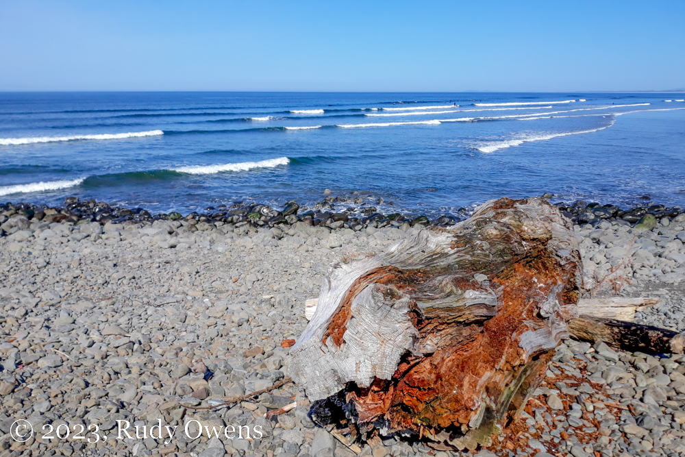
Rare calm waves visited the north coast of Oregon on March 18, 2023, bringing out dozens of surfers from miles around.
As my work day closed on the first day of spring, when those in the Northern Hemisphere recognize the vernal equinox, I also learned it was another important day.
Since July 2012, the United Nations has recognized March 20 as “the International Day of Happiness, recognizing the relevance of happiness and well-being as universal goals and aspirations in the lives of human beings around the world and the importance of their recognition in public policy objectives.”
The promise of a day surfing brings out my best, always.
The first day honoring happiness was observed on March 20, 2013. And I have been ignorant of the event for more than 10 years, it appears. Shame on me.
In its naming of a day dedicated to happiness, the body also “recognized the need for a more inclusive, equitable and balanced approach to economic growth that promotes sustainable development, poverty eradication, happiness and the well-being of all peoples.”
I have a lot more work to do to address issues that promote the happiness and well-being of all peoples. I come up far, far short.
From time to time I also need to care for my spirit. I long ago realized I could do little for others if I did not tend to myself. When the weather and free time allow it, I practice self-care in the Pacific Ocean, with a surfboard, to disconnect from things that weigh on me. Surfing for just a couple of hours allows me to just live in the moment to recalibrate my priorities.
By doing this I can better focus on what really matters in my life and what I do for others.
I hope everyone had a great day and will work the rest of the year with the well-being of others in their own, special way.
(Click on each photo to see a larger picture on a separate picture page.)
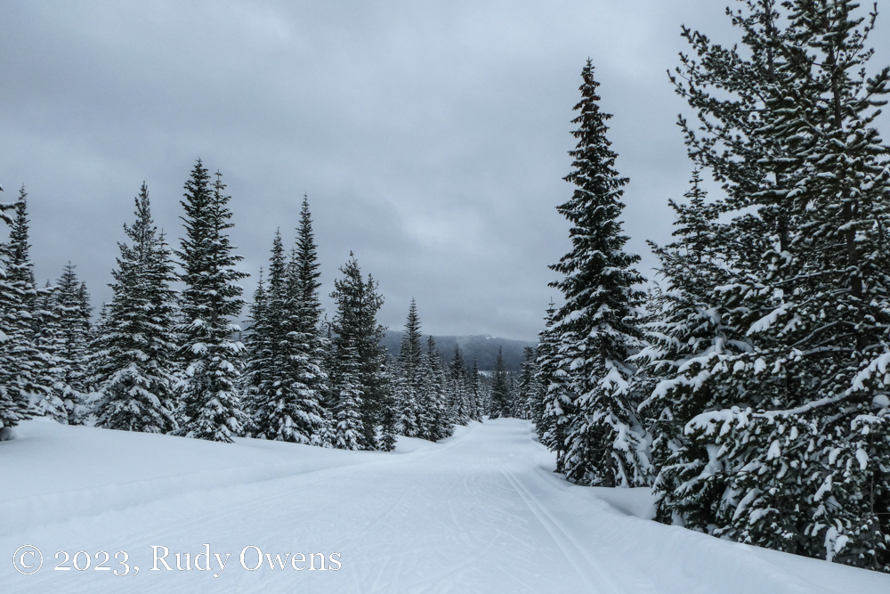
After weeks of planning to cross country ski, I finally did it. I am a bit tired, but feel alive.
Though I now roller ski every week, it is not the same as skiing on snow. There is nothing that compares to Nordic skiing on fresh snow. The workouts are always deeply fulfilling, and I can eat voluminous amounts of food when I am done.
For Nordic skiers of the world, this also is the time of year to Nordic ski the world over, in places where one can ski.
February and the first half of March is when the biggest ski races in the world happen for amateur skiers: the American Birkebeiner in northern Wisconsin at the end of February, the Birkebeinerrennet in central Norway in mid-March, and the biggest, the Vasaloppet races in central Sweden, at the end of February and first weekend of March. I was allowing myself the guilty pleasure of watching videos of these races from past years, but without getting out myself. I grew envious of Swedes and Norwegians who can ski all the time most of the winter. Me, I get wet this time of year, roller skiing in the rain or drizzle in Portland.
Cross-country skiing that is accessible from my home is fickle at best during the winter, and now more unpredictable with climate change disrupting winter weather in my region. The closest ski area is 75 miles away, on Mt. Hood, at a spot called Teacup, on the east face of the mountain. It is pretty, but it mostly has a lot of big descents and big climbs instead of long, flat straightaways. It is nothing like my fun ski life I had in Anchorage, from 2004 to 2010, where I could literally strap on skis and walk 100 feet to a shared used trail on most winter days.
Alas, all the ski videos got the best of me. I was antsy to get to the snow. Then we had a good new dump with consistently cold temperatures to make the drive to Mt. Hood worth it on March 5, 2023.
It was nice to finally skate ski again after 13 months of not being on a trail since my last trip to the Methow Valley. I miss being able to do it often, like I could in Alaska. My 150-mile round trip took four hours, involving some white outs, rain mixed with snow, and icy roads. It was a reminder to me why I may do it only once a year in Oregon and why I stick to roller skiing, which I can do any day of the year.
Yes, I do miss that snow. I am proud to say I face planted my first 10 yards today. I was so used to my roller ski balance I was unready for snow. Quickly, I found my muscle memory and soon was off for nearly three hours of looping the descents and long, lung-busting climbs. I saw nearly 50 cars and a lot of people out. Unfortunately, none of us saw Mt. Hood, which was mostly hidden in the clouds.
I want to give credit to the group that maintains the 24 km of trails here, on the Mt. Hood National Forest, called Teacup Nordic. It is a nonprofit that promotes nature, cross-country skiing, and healthy lifestyles encouraged by outdoor sports. The group is a mostly volunteer-powered. They run the venue and produce programs for kids, families, and adults. They do a good job. On many days, I Iike to see the morning photo of the trail groomer of the Nordic trails he’s groomed, telling skiers about conditions. It is a bright spot when all I see is rain in Portland. Thinking of a snowy trail still makes me smile!
Sellwood after the stormRamen shop, SellwoodSellwood Pool in snow
(Click on each photo to see a larger picture on a separate picture page.)
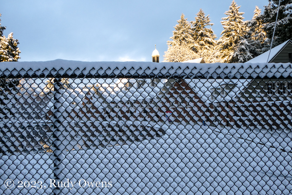
Around 3 p.m. on Feb. 22, 2023, big flakes began falling in my neighborhood in Portland, Ore. I did not think much of it, because the normally accurate National Weather Service’s winter storm warning only called for one to three inches through the next day. And to my surprise it really started falling. By 6 p.m., when I called it a day working at home, nearly three inches of snow had already fallen, and the blowing flakes were still coming down, heavy and wet.
After a nice and soggy snow walk, I settled in, wondering what the next morning would bring.
Much like Bill Murray’s weatherman Phil Connors in Groundhog Day, who finally sees a new day that ends his torment in Punxsutawney, Penn., when I opened the blinds at 5:30 a.m., I saw a massive dump of snow had accumulated. It was far greater than predicted. Our regional weather data gatherers reported Portland recorded the second-largest snowfall in a single day by the time it all ended, with parts of the city recording up to 11 inches of white stuff.
For hundreds of thousands, this historic snowstorm did what we know happens here, by bringing the commute to a crawl. Most drivers in Portland don’t have good winter driving skills, and the excess of large vehicle owners driving recklessly, causing mishap, not to mention trucks jackknifing and shutting down the arterials, paralyzed the evening commute. Countless big and “manly” pick-ups” and SUVs were abandoned, as were the semis, and it turned into a saga of six-hour commutes for many workers. I really felt sorry for most. I had that happen before to me, in Portland’s February 2017 snowstorm. I counted my blessings, as I am now a telecommuter. I will never forget how lucky I was not to be risking my life to commute–it’s something I hated doing for years of my life.
Before my workday began, I did a nice three-quarter mile walk in my neighborhood, snapping the proverbial winter shots I often do and relishing the snowy quiet.
Local and state transportation officials were urging people to avoid driving if they could, which is impossible for tens of thousands of people who have to work, particularly if they are essential workers. But the icy conditions probably grounded many, and those who showed up showed up like they always do, because when you work, you show up if you aren’t privileged.
As the day ended, I did a fun run through a snow covered wooded trail. It was glorious. I also marveled at narcissistic behemoth vehicle owners gunning it 50 mph on ice covered streets as if they were immune from laws of physics. They always do that here, because that’s who they are. Mostly, I smiled at the teens enjoying the bliss of sledding on a popular sledding hill. Now that was how to make the most of the weather.
As the nation navigates from extreme winter weather that cancelled thousands of flights, lead to fatal crashes by dangerous truck drivers, and imperiled many living on the margins, Christmas Day finally arrives.
Snow and ice hit the Pacific Northwest, blanketing Seattle in perilous ice and closing portions of Interstate 84 outside of Portland. Fortunately, Portland had mostly light snow just before Christmas eve that today, Dec. 25, is turning to wet, soppy mush.
To everyone who is braving the elements or trying to connect with families and friends, please travel safely. Enjoy the season and, if you can, be kind and think of others who may be less fortunate.